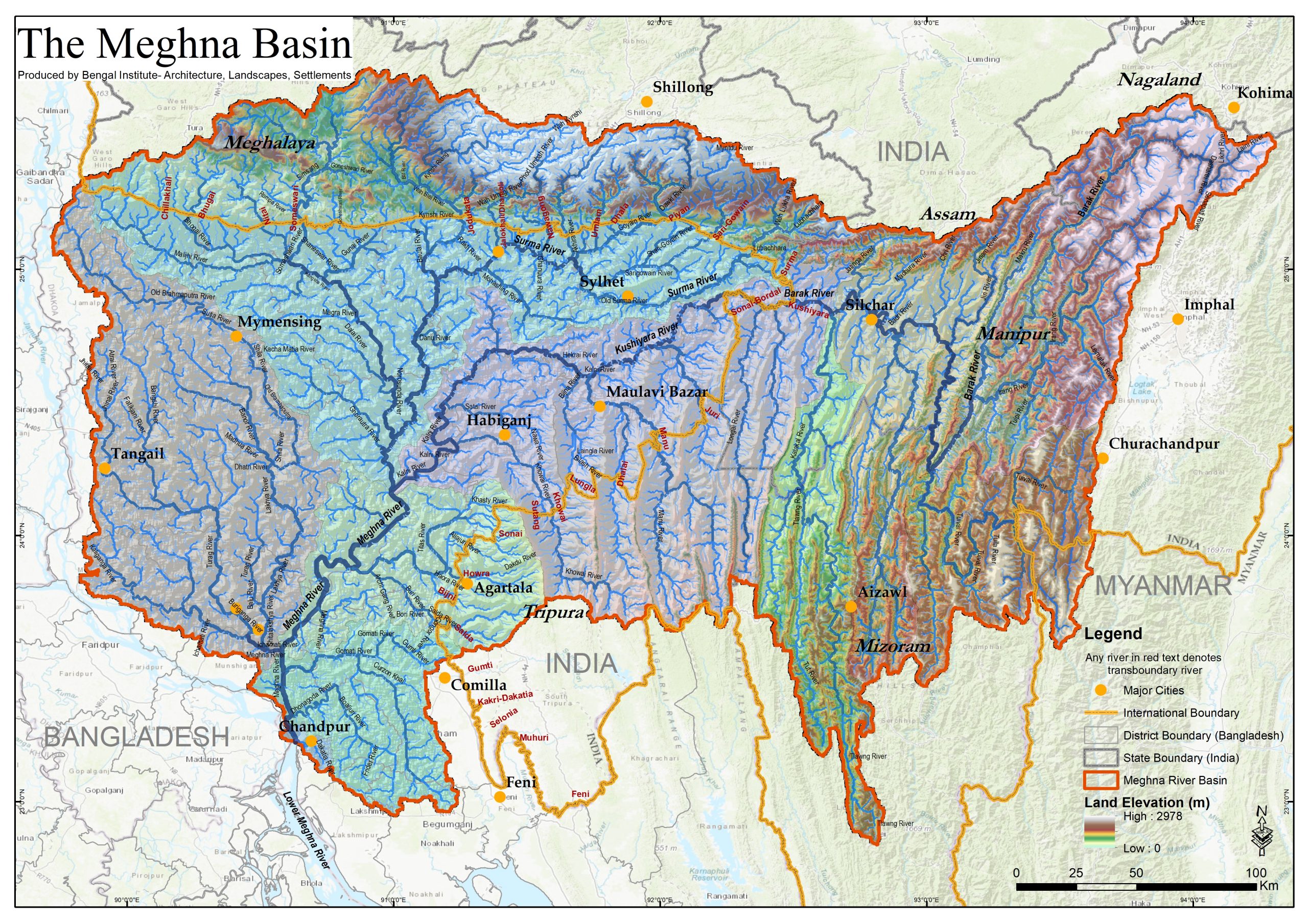
The Meghna River basin, a sub-basin of the GBM river system, covers 85,385 sq. km. area (46% in Bangladesh and 54% in India) and holds around 38 million population. According to the Bangladesh Water Development Board, Bangladesh Inland Water Transport Authority, Survey of Bangladesh, and various published literature, 505 river names have been identified in the Meghna Basin, of which 440 are within Bangladesh, including 29 transboundary rivers. Although the Meghna River receives a vast volume of water from the Old Brahmaputra River at Bhairab Bazar point, the perennial flow is discharged from Surma and Kushiyara rivers which originated from the Barak River. Its segment from Chandpur, where the mighty Padma River confluences to the Meghna estuary, is called the Lower Meghna River, one of the largest discharge carriers in the world. Major tributaries of the Upper Meghna River are Kalni, Old Brahmaputra, and Dhaleshwary rivers, and of the Lower Meghna River are Padma, Gumti, and Choto Feni rivers. Though the Tentulia River at Bhola is the only valid distributary of the Meghna River, a segment of the Arial Khan River also receives water from the Lower Meghna River. Other significant rivers in the basin are Manu, Khowai, Sonai, Goyain, Lakhya, etc.
Note: BI is working on the identification of these rivers on the latest high resolution
(4.7m) satellite imagery.
Author/s: Bandhan Dhar and Sanjoy Roy
[GRU is the Geographic Research Unit of Bengal Institute]