Banner

BI/GRU Research Logs: The Mapping of Tree Canopy of Dhaka City

Tree canopy coverage within the urban context of Dhaka

The extent of tree canopy cover within urban contexts plays a pivotal role in various ecological, environmental, and public health benefits. For implementing effective conservation measures, and thus retaining the benefits, mapping of tree canopy cover is crucial for Dhaka city. Acknowledging the exigency of establishing a robust tree canopy database, the BI/GRU team has undertaken, for the first time in Bangladesh, the formidable task of counting, mapping, and analyzing trees. As part of this endeavor, the team assessed tree canopy areas within 23 wards of the Dhaka North City Corporation in the first phase of the study.

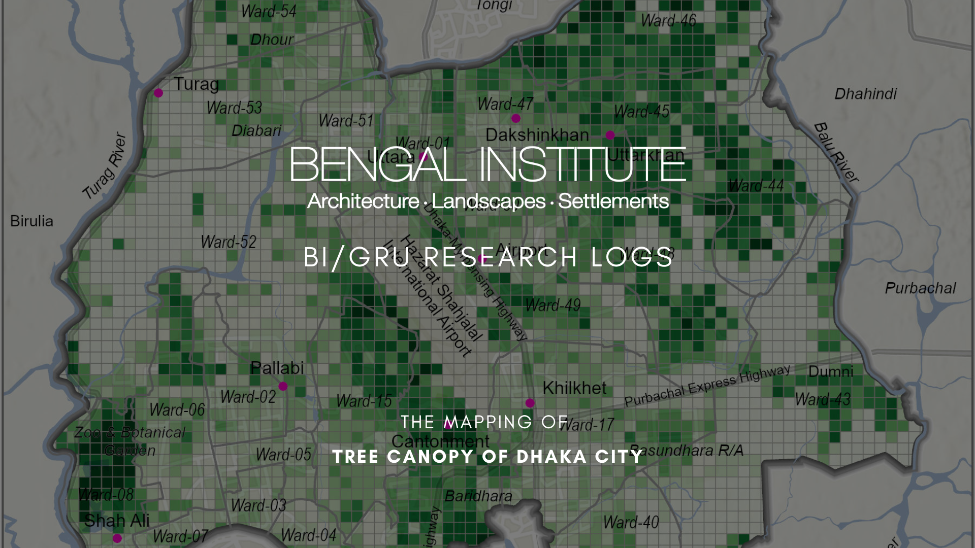
In those 23 wards, around 250,271 tree canopies covering 2,311-hectare area are identified, which is 18% of the area. In our analysis, Uttarkhan, Cantonment, and Shah Ali Thana were found with highest tree coverage; it is at least 30%. Our analysis further revealed a 34% decline of tree cover in a 1 square kilometer grid area located at Ward-54 (Bhatulia) in the DNCC.

Author/s: Bandhan Dhar and Sanjoy Roy

[GRU is the Geographic Research Unit of Bengal Institute]