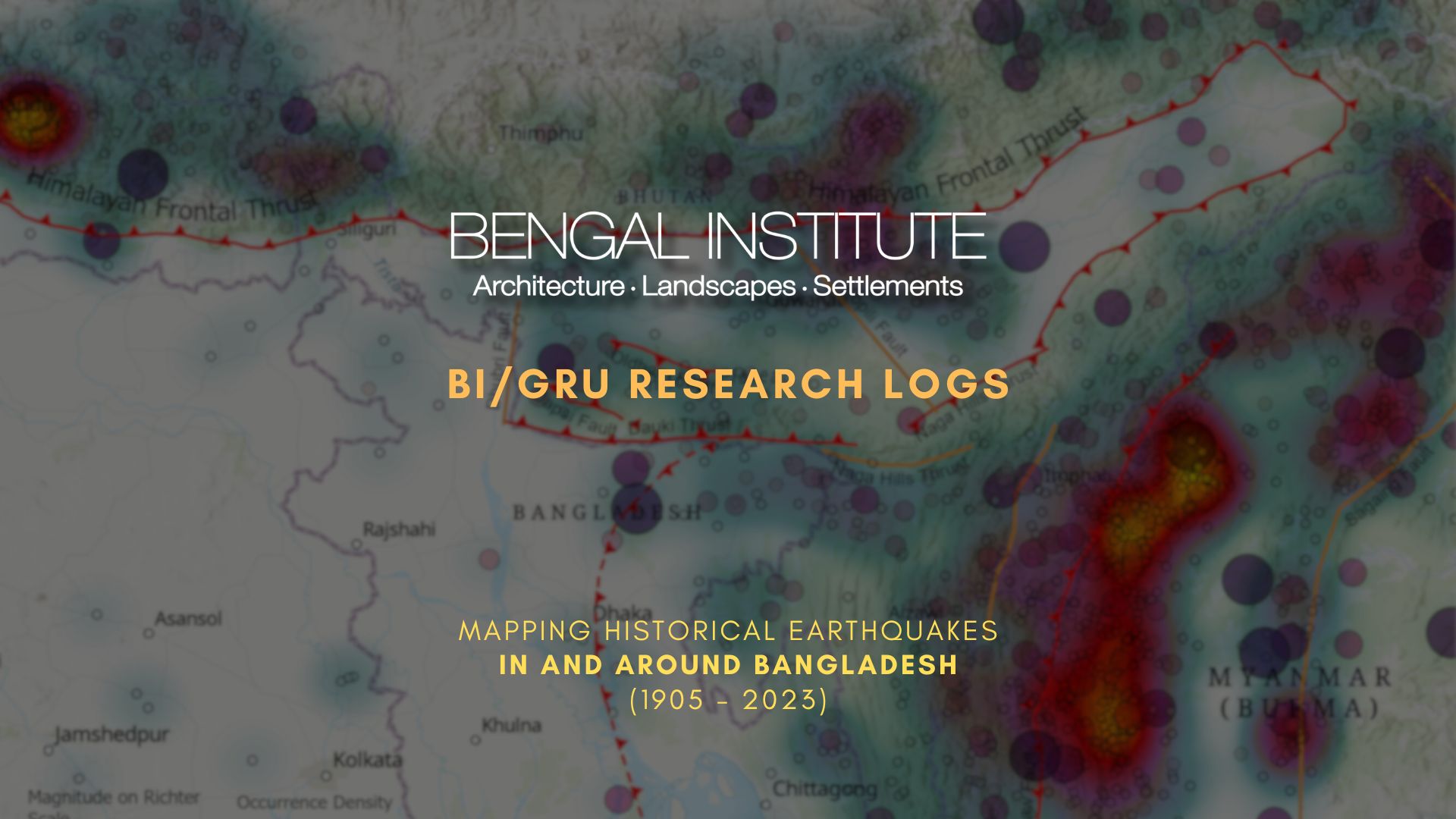
Bangladesh and its surrounding regions, situated on the boundary of the Indian Eurasian-Burma tectonic plates with five prominent faults, are at risk of high-magnitude earthquakes. Notable historic earthquakes in this region include the 1762 Bengal Arakan Earthquake (8.5 Mw), which caused 500 deaths near Dhaka. In 1897, the Great Assam Earthquake (8.03 Mw) led to 545 casualties in Sylhet. In Dhaka, almost all masonry buildings were badly damaged. The 1918 Srimangal Earthquake (7.1 Mw) resulted in the reported destruction of almost all tea factories and bungalows in Srimangal (Moulvibazar). These earthquakes causing significant damage and casualties highlight the country’s vulnerability to seismic hazards. A survey conducted by RAJUK in 2018 reveals that 65% of Dhaka city is at high risk of earthquakes, where around 90% of the buildings in Mirpur, Mohammadpur, Pallabi, Rampura, Motijheel, Khilgaon, and Dhanmondi are highly vulnerable due to their non-compliance with the necessary design and structural standards. According to experts, earthquakes with a magnitude of 7.0 on the Richter Scale occur approximately once every 100 to 150 years. If this assessment holds true, a significant earthquake is looming on the horizon, poised to strike at any given moment.
Based on data from the USGS Earthquake Catalogue, the GRU team of Bengal Institute has developed a time-series map of earthquakes that occurred in and around Bangladesh from 1905 to 2023. The illustration also shows the density of earthquake occurrences on the regional scale.
Author/s: Sanjoy Roy and Bandhan Dhar
[GRU is the Geographic Research Unit of Bengal Institute]