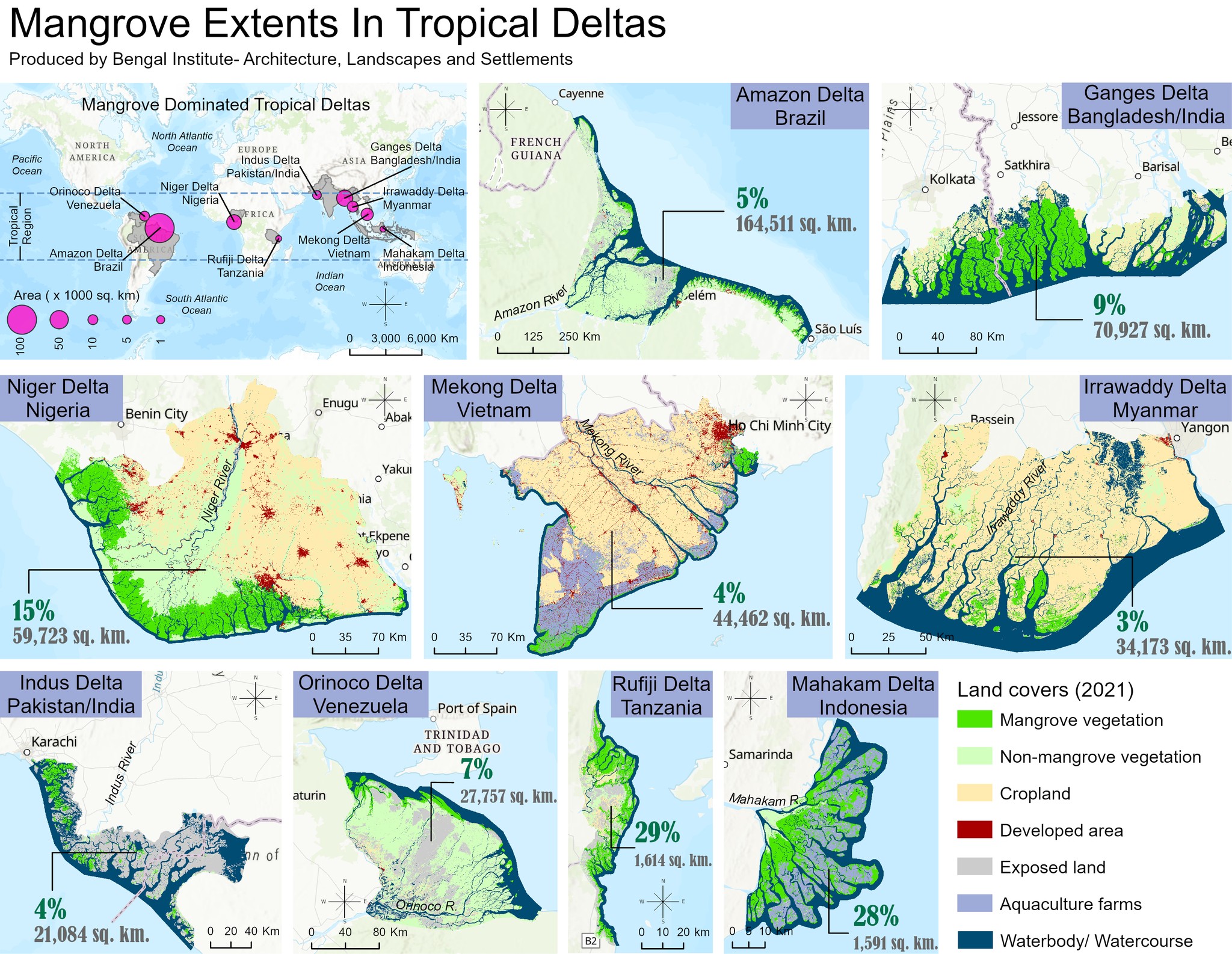
The mangrove is one of the most productive coastal ecosystems on earth that supports multiple ecosystem services to human beings, and provides habitats to a wide variety of flora and fauna. At present, the global extent of mangrove cover is estimated as 147,359 km2 area, and is largely distributed in the coastlines and deltas of the tropical and subtropical regions. Deltas are of particular interest because of their growing population, diversified socio-economic activities, and extreme exposure to natural catastrophes, which collectively exert tremendous pressure on their mangrove system. To date, the quantification of mangrove loss in tropical deltas is unexplored. There is also a lack of time series mapping of the mangrove cover in those deltas. In this regard, GRU of Bengal Institute developed a time series analysis of mangrove coverage of nine major tropical deltas using multitemporal satellite imagery and Machine Learning approach. This intensive geospatial investigation summarized that Rufiji (Tanzania) and Mahakam (Indonesia) deltas have the highest percentages of mangrove extents in respect of their delta sizes. The Ganges Delta, located in Bangladesh and India, holds only 9% of the mangrove ecosystem compared to its area. Indus (Pakistan), Irrawaddy (Myanmar), and Mekong (Vietnam) deltas currently have less than 3% mangrove coverage.
Authors: Sadiqun Nahar and Sanjoy Roy
[GRU is the Geographic Research Unit of Bengal Institute]