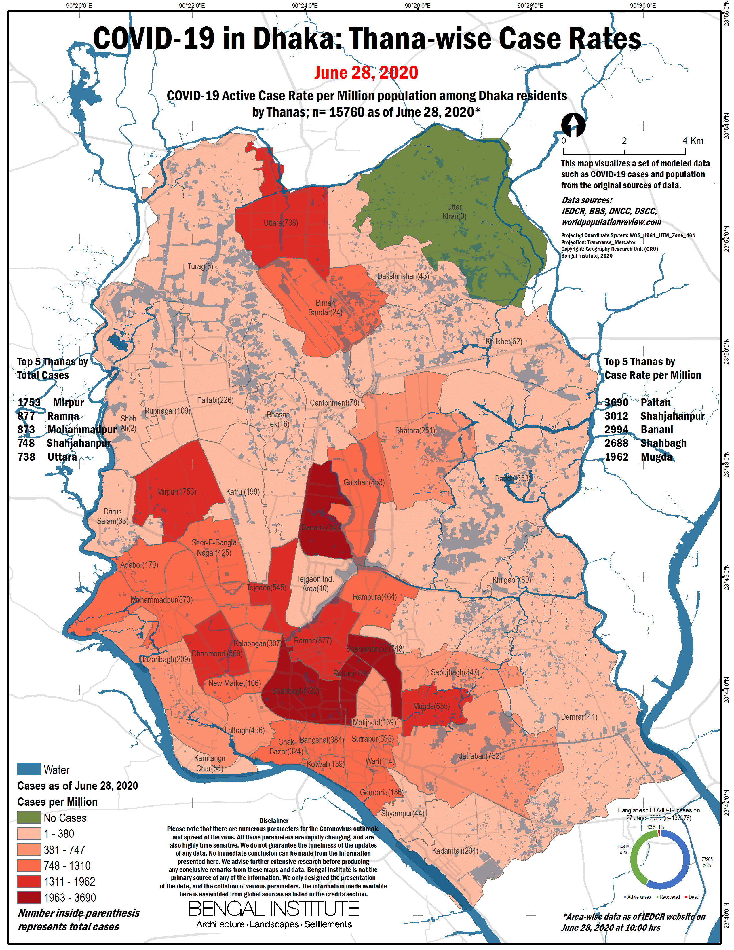
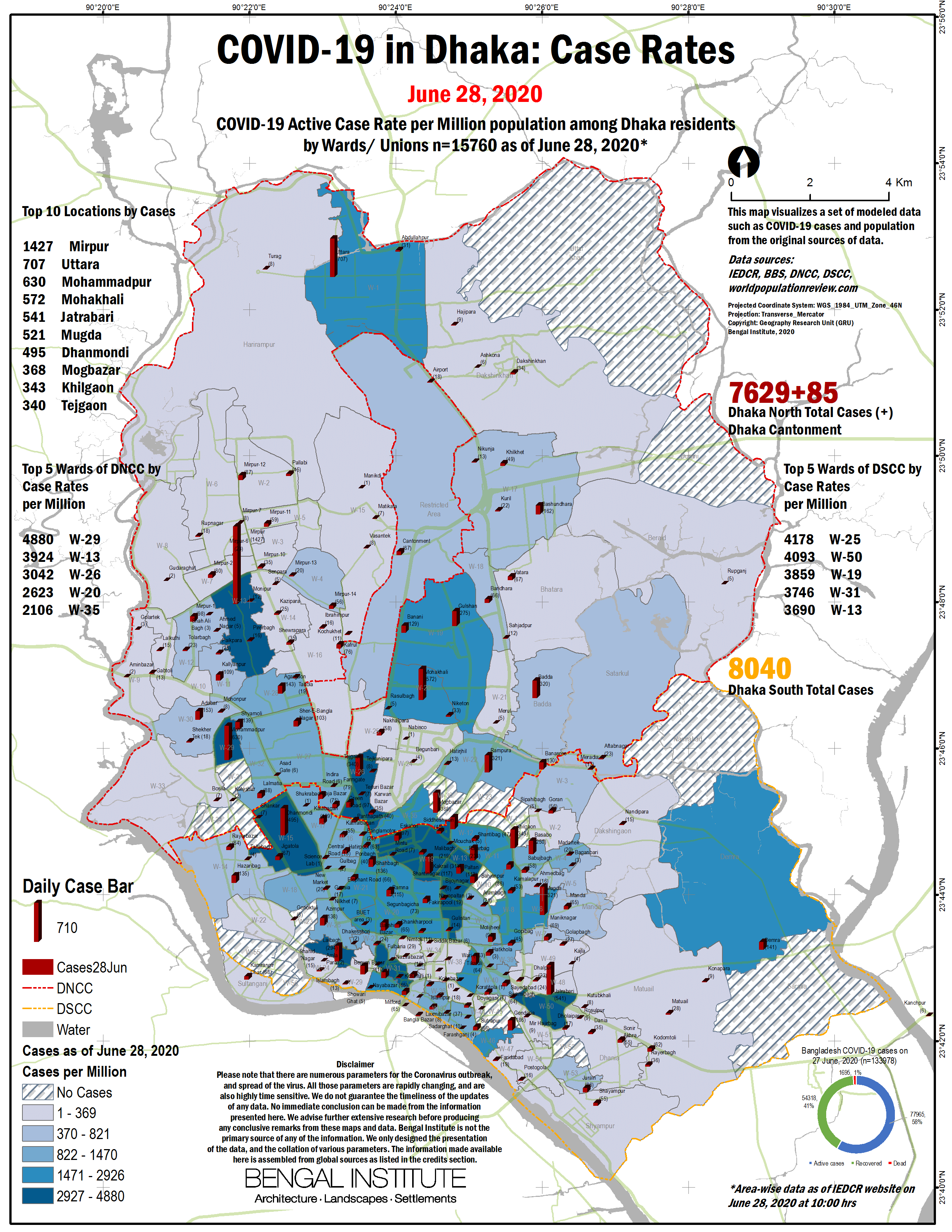
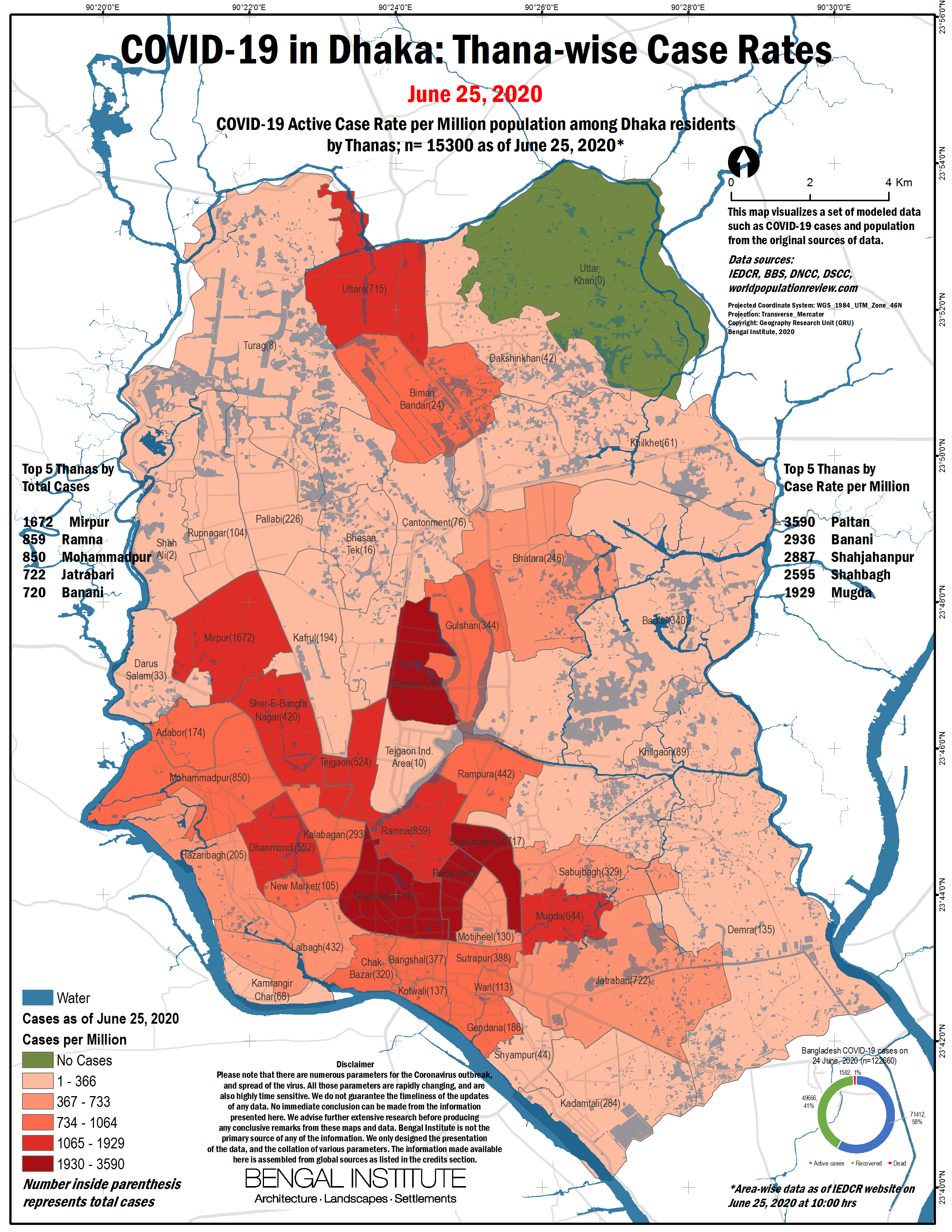
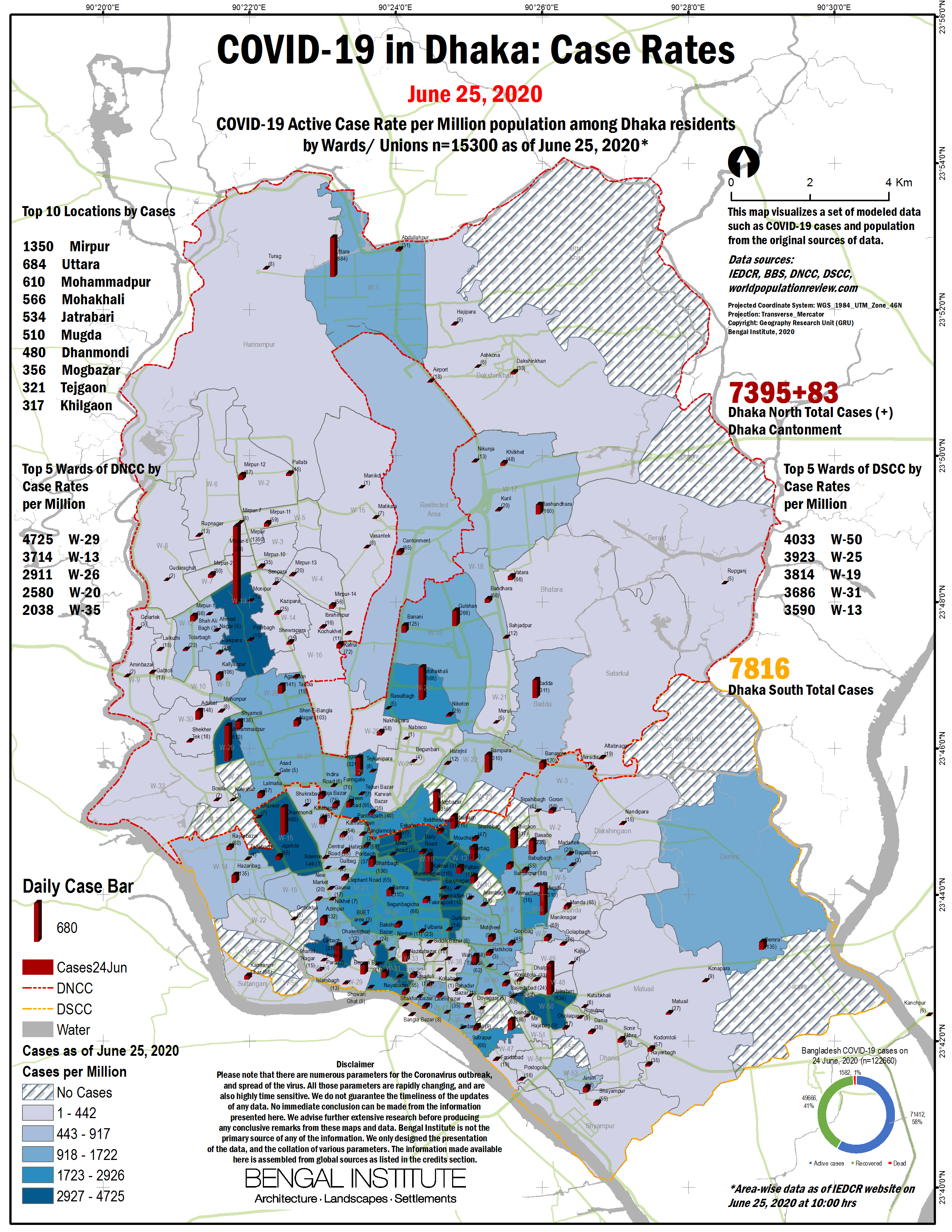
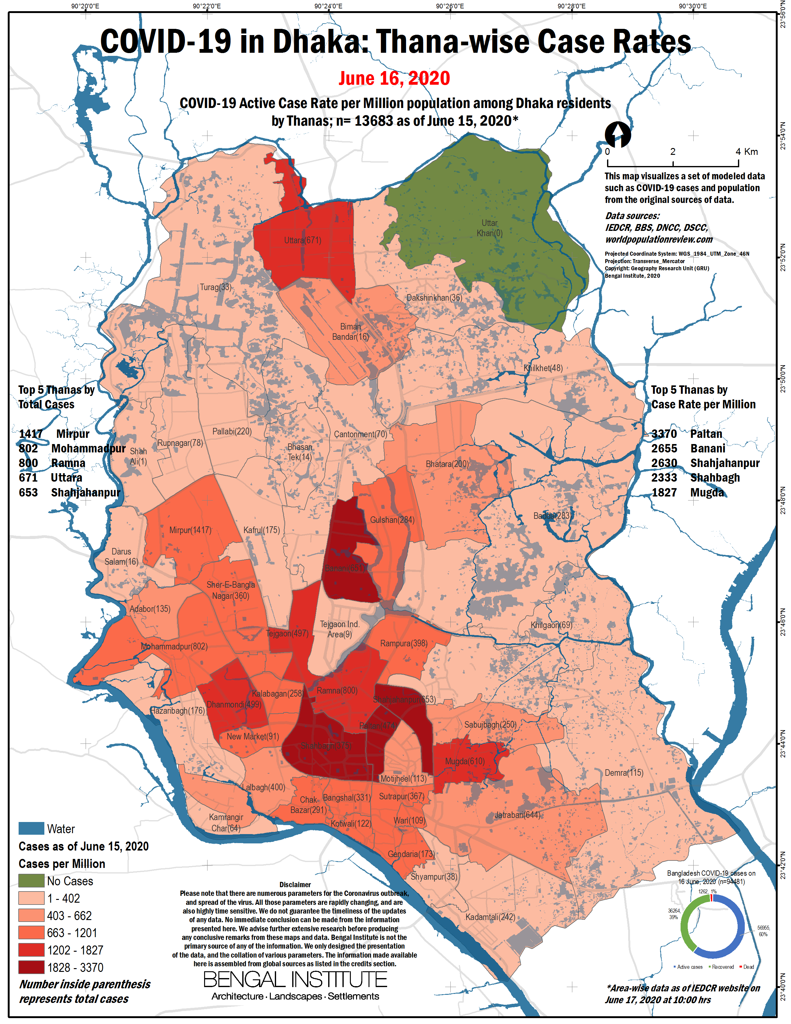
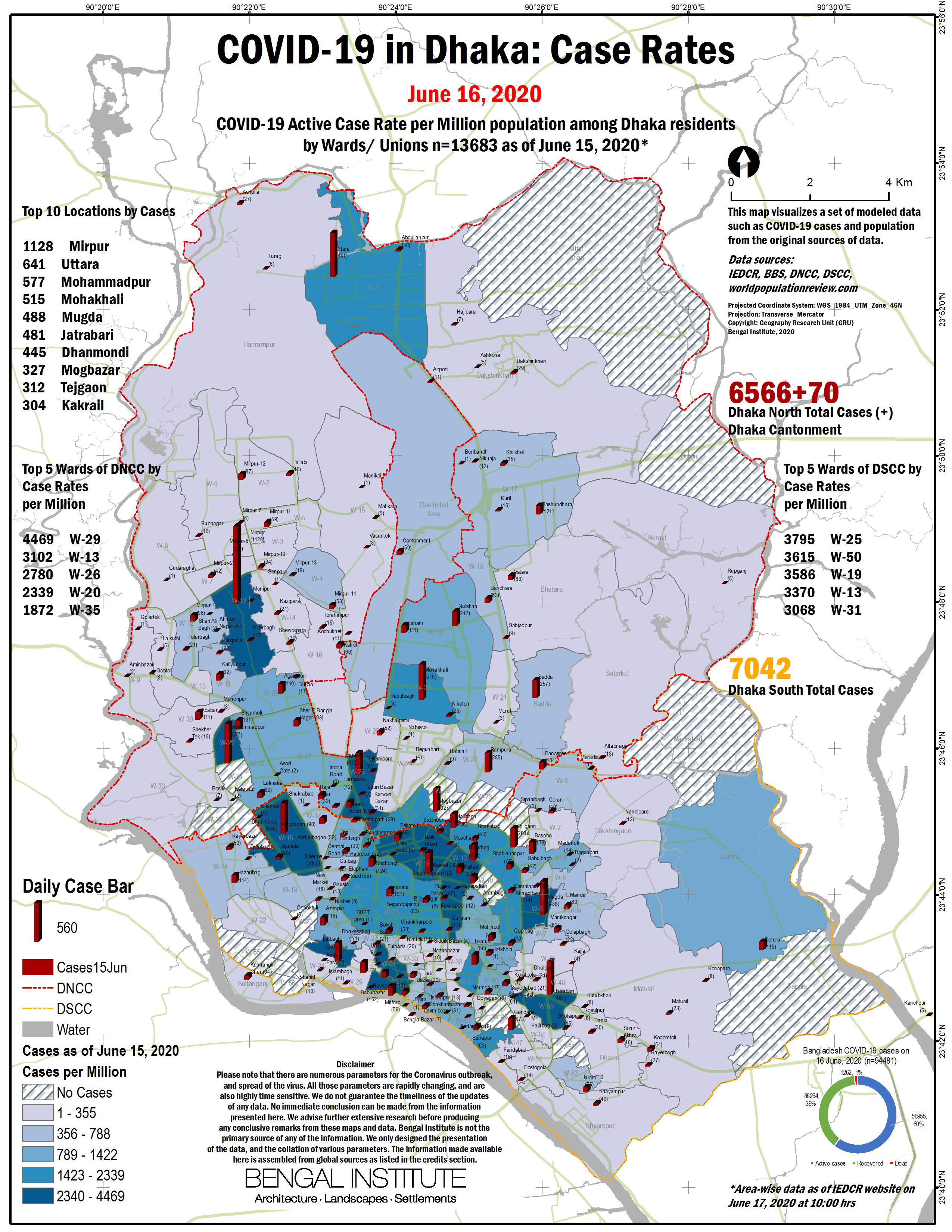
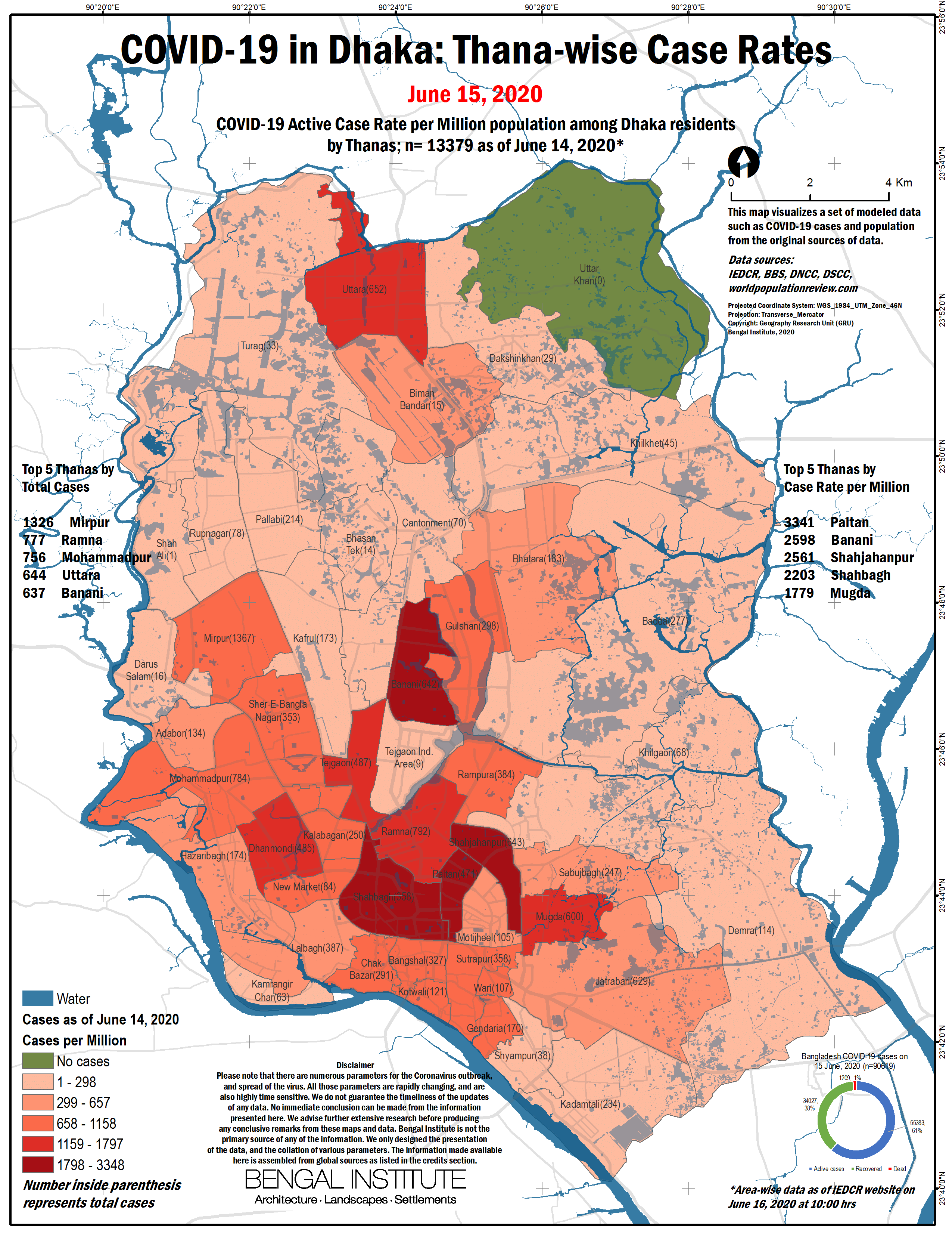
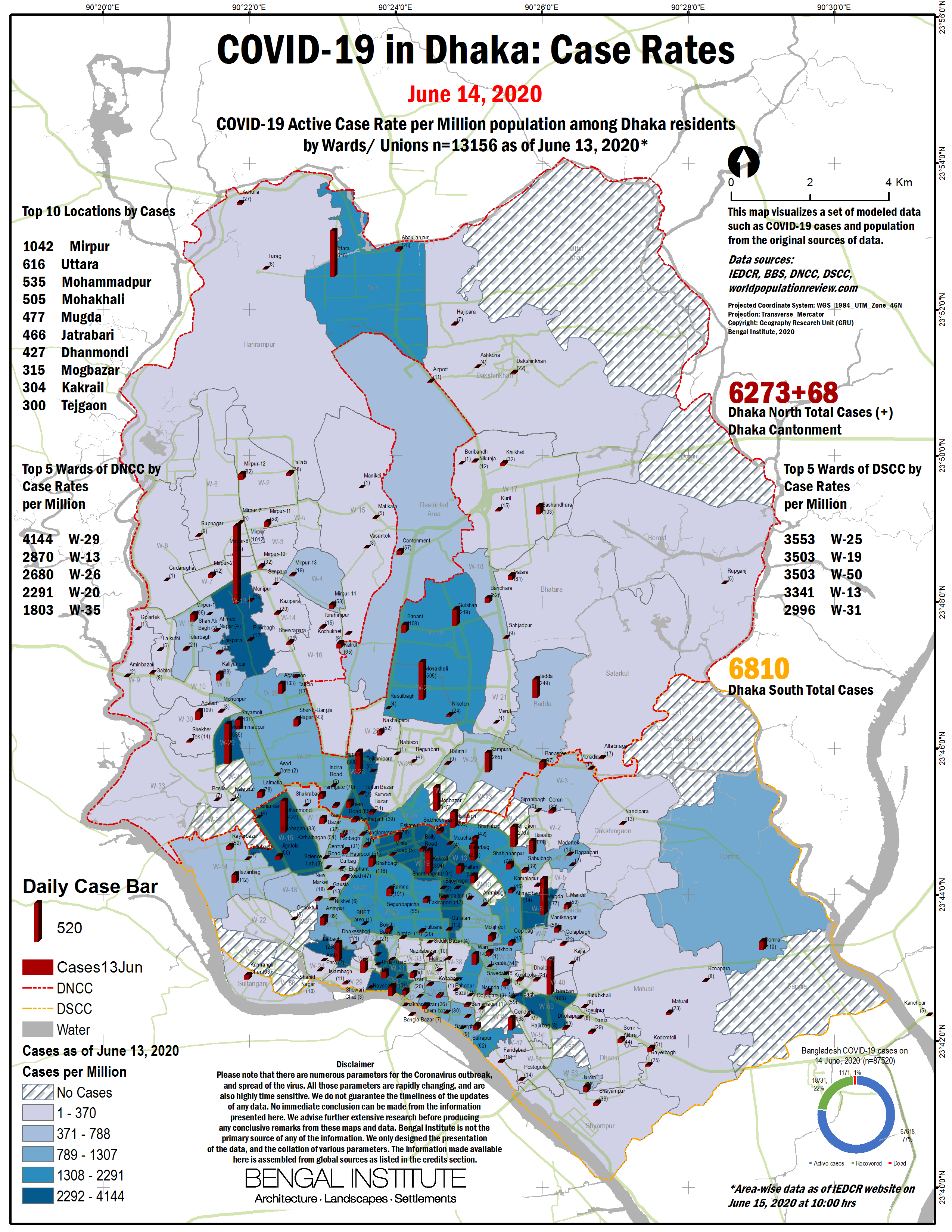
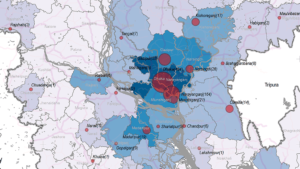
These maps are produced daily based on the data published on the website of IEDCR of Bangladesh Government, on the spread of Coronavirus and Covid-19 infection. The slideshow above has the latest and *older ones.
*IEDCR did not publish the data of
– 23rd April, 3rd May, 4th May, 13th May 2020 for Dhaka neighbourhoods.
also IEDCR did not publish data on Dhaka City (DNCC, DSCC) regularly after 16th June.
Interactive Map
Launch Full-screen Dashboard [Better viewed on computers]
Note: The dots are not exact locations! They are randomly placed within a boundary of neighbourhood or district.
Disclaimer: Please note that there are numerous parameters for the Coronavirus outbreak, and spread of the virus. All those parameters are rapidly changing, and are also highly time sensitive. We do not guarantee the timeliness of the updates of any data. No immediate conclusion can be made from the information presented here. We advise further extensive research before producing any conclusive remarks from these maps and data. Bengal Institute is not the primary source of any of the information. We only designed the presentation of the data, and the collation of various parameters. The information made available here is assembled from local and global sources as listed in the credits section.
For everything else on Bengal Institute’s COVID-19 efforts click:
Short link to this page for easy sharing: https://bit.ly/COVIDhaka
Related Research